Showing posts with label hiking. Show all posts

Thursday, October 6, 2011

Boundary Trail - Part Two

At Cathedral Lake
So from Cathedral Pass we hiked down through glorious lake basins and boggy meadow high country. We landed at Remmel Lake for the night where we met up with acquaintances at their "drop camp" who had our food re-supply for the second half of the trip. Spent the only frosty night of the trip at Remmel Lake; turned around the next morning and headed back the way we came.

But don't forget: the way back is never exactly the same, Grashopper . . . .
A view of Cathedral
Remmel Mountain peaking up behind the high meadows
Remmel Lake and mountain at dawn
Two hikers ready for the return trip
Frank navigates a tricky stretch below upper Cathedral Lake
Our much-welcomed tarn at Sheelite Pass
Perfect campsite on granite at Sheelite Pass
Hiking out the final morning we encountered Frank's internist, Dr. Chris Hogness, accompanied by seven pack goats. Family still asleep in tent on other side of Sunny Pass.
Pastel dawn in Horseshoe Basin

A trek along the Boundary Trail - Part One


You belong among the wildflowers . . .  in Horseshoe Basin.
The Boundary Trail runs roughly parallel to the U.S.-Canadian border, just a few miles south of the international swath in places. From August 24 to August 29, Frank and I hiked the trail roughly three days in one direction (Iron Gate to Remmel Lake) and then turned around and retraced our steps to the trailhead above Toat's Coulee out of Loomis.

The weather was hot and sunny the whole trip; the bugs were horrendous - tent-screen-covering mosquitoes in camp, biting flies on the trail in the afternoon; the views were outstanding.

I still appear fresh on Day 2.
Sunny Pass - looking back the way we came.
Lowden Lake early morning.
Bug netting was all the fashion in camp.
After-lunch snooze.
BIG trail junction at Tungsten Mine.
Ancient rails lead out to the tailings pile. Apex Mountain.
Mine artifacts. Frank on tailings pile.
Apex Peak from Apex Pass. I stayed below and applauded wildly while Frank bagged the peak.
First view of Cathedral Peak; the pass is in the left saddle.
Frank on switchback approach to Cathedral Pass.
The view west from Cathedral Pass.
Trip to be continued in Part Two . . . .

Wednesday, July 27, 2011

Last weekend up Twisp Pass

Day hiking for us around here usually means driving 30 minutes to one hour to get to the trailhead (not forgetting the appropriate parking pass - state or national?) and then heaving our bodies uphill for several hours, having lunch, and then lurching our way downhill to the car. Gosh. It doesn't sound that great when I put it that way. Must be my painful joints talking . . . .
Anyway, we hiked up Twisp Pass on Saturday. It is SUCH a beautiful trail.

I told Frank we pretty much saw the whole wildflower book along the 2600 feet of elevation gain.
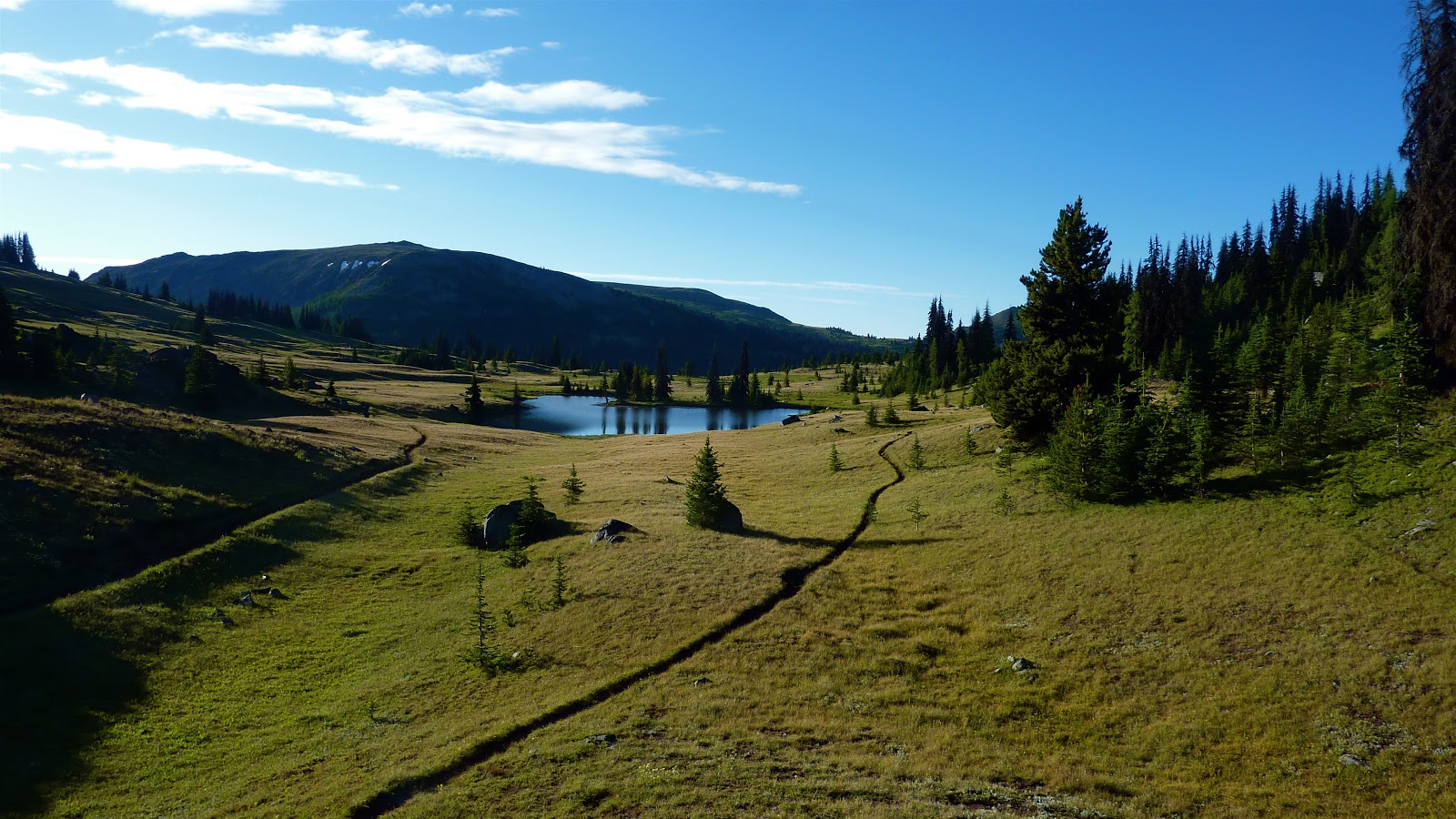
That's Hock Mountain there with the headwaters of the South Fork of the Twisp River in the valley below.
We traveled on snow for a while. It's almost August for goodness sakes! Some trails may not be snow free before snow flies again.
Beware the pink snow monster.
A good 4 to 6 foot base of snow here still.
We had lunch slightly above the pass. Yeah. I'm always thrilled to keep going UP, but certainly the views were worth it.
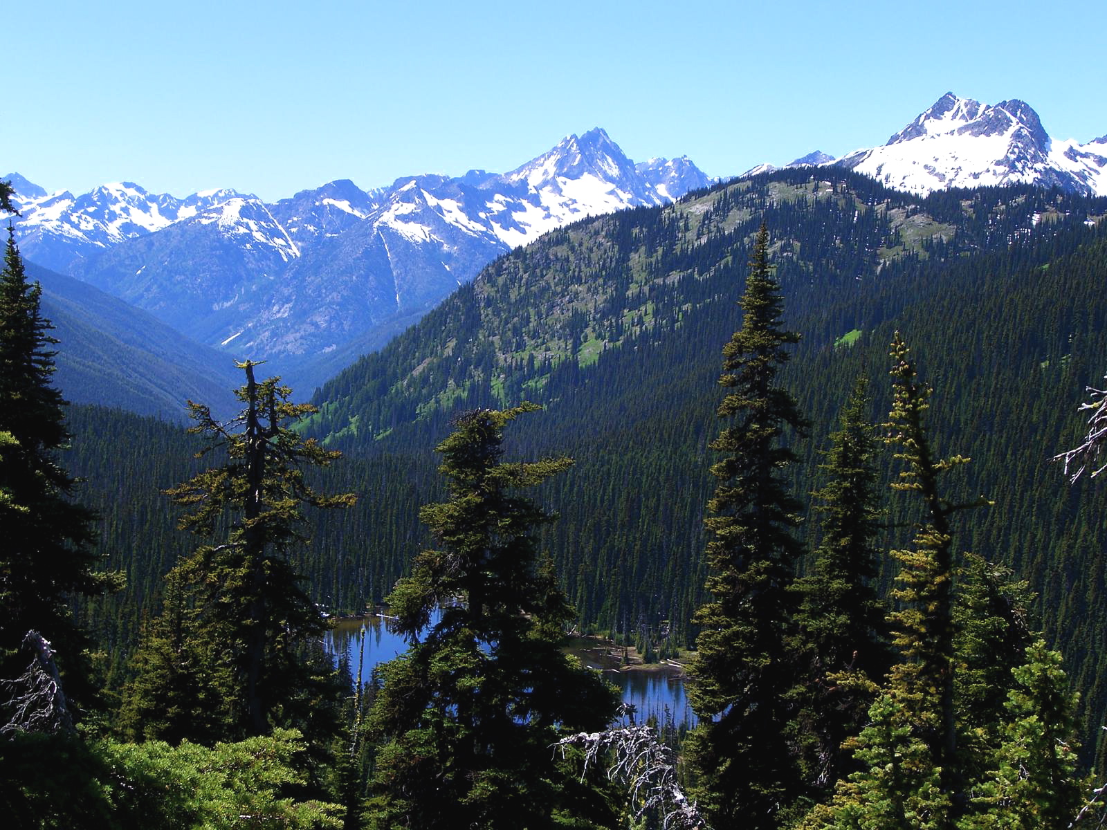
That's Dagger Lake below and nothing but national park in the picture.
I really like wooden signage in the wilderness.

This weekend we'll drag our butts up some other god-awful trail. Maybe Copper Glance. Maybe someplace in the Sawtooths. Any suggestions?